PHOTOS —>> Mainland Panama and back to San Blas islands
 Our first stop along the coast of Panama was Linton Bay. This is a beautiful, large, bay where they are building a new marina. We spent 2 nights there and really liked the area. There is an island where monkeys live around an abandoned house. Near by is a small beach where we went swimming.
We also visited the new marina to get information in case we leave the boat there when we fly home. Meeting a number of the folk living there we feel it is definitely a great set up. We will be back.

Shelter Bay, Colon Panama
We came into Shelter Bay marina in Colon Panama. John had promised our 
 Australian friends Lynne and Eric, on Amurula (a 60 foot catamaran that’s 3 stories high), to be a line handler for them through the Panama Canal. That meant that on the Wednesday just after we arrived he went on their boat, which was anchored in the Flats area off Colon. They started to transit the canal on
  the Thursday late afternoon. They went through a series
  of locks and rose upwards towards the Gatun Lake. They went along with massive ships some being bigger than any he’d ever see before. John reported that all he and the others did was hold the lines from the 4 corners of Amarula while she rose upwards. Then repeated
 this in each lock. He said it was really easy. They spent the night on Gatun Lake tied to a buoy. The pilot arrived at 10:00 the next day, (only 3 hours late), and they crossed the lake. The lake he said was very beautiful with just jungle at the sides and islands that again were just jungle. They could hear the howler monkeys. Gatun Lake is very beautiful with absolutely no inhabited areas as it is protected. Then they went down the locks on the other side to the Pacific Ocean. John said they had a really great time, total party the whole way, the company was great and the food and drink excellent.
 Meanwhile I stayed at the marina with Chico. Oh it was fine; I took the free marina bus to the Albrook mall in Panama City one day. It is the largest mall in Central Americas, just massive, about a mile long, 2 lanes of it and 2 stories high. You can buy anything there. Other days I took the shopping bus to Cuatro Altro a small shopping plaza
 where I started stocking up with supplies.

Now a ride on the marina’s free bus to get to any type of shop, ATM or service takes over an hour and longer if the locks on the Panama Canal are open. Open means you wait for the ships to pass through.

Shelter Bay marina is the only one in or near Colon. There is nowhere else to leave the boat in safety. The marina is situated where the old Fort Sherman was located, where the Americans had their facilities in days gone by. They left and the area has become Shelter bay Marina in one part and the “Police/Army” inhabit and train in another section, the rest has started to return to the jungle. We enjoyed poking around, riding our bikes down the lanes in the forest and exploring.
The howler monkeys scream like monsters in the jungle, we’ve seen spider monkeys and others, tons of different birds, beautiful large blue butterflies and animals like anteaters. It really is wild.

From the marina we had a few expeditions. The first was exploring the Kennedy Loop and the Battery area, that part of the old “fort” is being reclaimed by the jungle. It is very lovely walking under the shade of the trees with enormous blue butterflies, and others of various colours flying by, birds of every type in the trees and as said the howler monkeys growling/screaming in the not so distant foliage. We saw Capuchin or Spider monkeys in the trees above. They kept trying to climb into the branches above us, wondering why, I watched them over John and could see they were trying to pee on his head!


Our next walk we took was along the breakwater towards the entrance to the Panama Canal harbour/anchorage for ships. This breakwater is long as in a good mile and the rocks are not smooth traveling so I guess we got maybe a ¼ of the way across. The view was excellent and we got quite close to  some vultures. These vultures are found everywhere in Panama. They seem to clean up after everyone and everything. They are large, black and I think quite handsome. After the breakwater we walked along the shoreline, which was at low tide. Again it was very enjoyable.
Another few explorations were on our bikes. One full day we rode down the lane

 to San Lorenzo – the fort – at the mouth of the Rio Chadres. It was not as easy as it had looked getting there, as it was all a gradual uphill slog. Arriving at the fort we were really happy to find that it was well worth the effort. It is on cliffs above where the estuary of the river Chadres meeting the sea, the view was stunning and the breeze was divine after our ride.

The fort is the typical old Spanish colonial style, well what is left of it. We strolled around exploring the fort and down to the beach near the fort.

From the fort we rode our bikes following a long lane through the jungle to the Playa/beach. This beach was also at the mouth of a small river and again very scenic. There we had our picnic lunch and stretched our legs.

On we went to a supposed Prack battery, again left from  the American base, but it was
very odd as there was a man at the battery with a large gun and a dog, plus we could see others below the battery. We had a quick look round; decided we were not welcome and left, (the man, gun and dog followed us to the gate). Can only guess they were involved with some sort of smuggling, probably drugs. After we rode back, it was a ride of about 12 miles.
 We went to the Free Zone one day, the biggest duty free area outside of Hong Kong, or so we were told. It seemed like the whole size of a city. Of course we didn’t buy anything, as it was too big to know what to get or where to start. Plus being in Colon you just do not feel safe. Just driving through a small part of Colon to get to the Free Zone, we saw terrible slums; it was not nice at all.
Panama is not what we expected. It is very undeveloped, more so even than Colombia. The only developed area seems to be around the canal, Colon and Panama City, like 3/4 of the country is National Park. The National Geographic Society and Smithsonian institute have stations and research ships in Panama, Rio Chadres and Gutan Lake. The country is just full of wildlife with hundreds of square miles of untouched, unpopulated, areas of national parkland.

We left Shelter Bay Marina after 2 weeks of getting nearly everything we needed, getting the fridge repaired, having several get-togethers and pot lucks with new and old friends, many rides on the free bus and doing all the necessary cleaning and laundry. Off we headed back to the San Blas Islands.
Portobello
Our first stop along the coast was Portobello. It was first founded in 1597 under the name of the City of San Felipe de Portobello and became one of the most important sites for the transfer of the riches from the Americas. In the bay at Portobello we spent 2 nights and really enjoyed the bay and village. It is a large bay with many other sailboats, but as it is large there is plenty of room. We anchored under the old fort on the northern end of the bay. Walking through the village we found quite good grocery stores, a very nice bakery and good
  restaurants. The ruins of the old San Felipe de Portobello is next to the village it is very old to say the least. The outer walls are still sort of standing but the sea
  is encroaching and reclaiming the area. The fort on the southern side of the bay is being restored. It was interesting to walk around and see all the canons facing out to sea. In fact in all the forts in the Portobello area there are
  at least a few dozen canons still facing out to sea. We visited the old church and saw the famous Black Jesus who was brought to Portobello hundreds of years ago and today is reputed to be responsible for miracles, hundreds come to pray to him.
 We hiked to the top of the fort above the boat. This is a 3-layered fortification. The 1st being at sea level
  then up a steep incline is the second level and after a longer even steeper climb we found the top
 fortification that looks out over the whole bay. The view is just amazing. Once again we could hear the howler monkeys making off in the jungle around us
  and saw dozen of beautiful butterflies and all kinds of exotic birds. We watched the leaf cutter ants as they trudged along with massive leaves attached to their back. Their pathways are several inches wide. They are quite impressive insects.

Linton Bay
 Leaving Portobello we decided to stop into Linton Bay to see if we could find a
 cat sitter for Chico. Our plan was to visit Panamarina and some of the resident cruisers in this area. The visit to Panamarina proved to be well worth it.
The dingy passage through the mangroves was simply amazing. It was beautiful, full of birds and on  the return monkeys! We had black and tan monkeys jumping all over the mangroves by our dingy. They were quite curious about us, stopped came closer and stared like we were aliens. Plus at Panamarina we were able to book the boat in and had the promise of someone to care for Chico while he is home alone on the boat.

In the end we stayed 2 nights in Linton Bay and had an excellent time. We explored the mangrove 
 channels and found them to be exceptionally beautiful. Took a hike to the little village of Puerto Lindo met up with a friend from the past, John on Stingo and had drinks while trying to introduce our cats, that did not go down well with the cats. And we caught up with other friends from the marina there.


 San Blas Islands: Lemmon Cays,
Our passage from Linton to Lemmon Cays was for me long and tedious. The 1st part being very close to the wind with a sea that was irregular and off the bow. In other words we were healing over and being slammed. However the second half of our passage went better and we arrived just before the evening able to make the outside passage in. We spent the night at Lemmon Cays and then moved along to:

Maoqui – Kaimou – Holandes Cays: between Acuakargana and Waisaidup

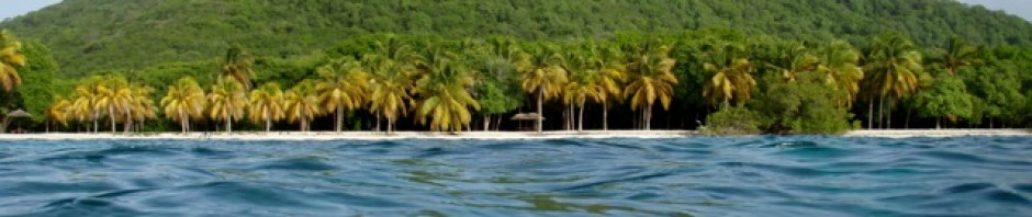
 We headed to the fabled Holandes Cays, called Kaimou in Guna and Maoqui by the Colombian traders and anchored between Acuakargana and Waisaidup in the waterway that rushed between the two. It was absolutely beautiful! The water clear, clear, clear, just pristine! The two islands looked like a tropical paradise.

 While there we walked around Waisaidup and found a few Gunas
  living there, probably to tend the huge coconut forest. The waters were all colours of turquoise with the shallows rolling ashore it was absolutely idyllic.
We snorkeled several times and found the reef excellent. There  were magnificent corals of all types, schools of all different fish, eels in the rocks the reef was alive with life.
The snorkeling was excellent! In the evenings we saw  dolphin chasing the school of Jacks, which were chasing the Fry as pelicans swooped and plunged into the water. Chico was very entertained with the life around the boat. This is definitely an anchorage where we will return and spend more time.

We moved along the Holondes chain to an anchorage off of Miriadup where we were the only boat. This again was a wonderful setting with white sandy beach ahead of us, shallow reef to snorkel around us and an island to explore that’s uninhabited. The island is quite large and we enjoyed a great walk around half of its shores. The windward side was just smothered in one part with trash – mainly plastic, and driftwood. I liked looking for treasures and found several lovely shells and many sea beans.

The off shore reef had a large ship aground which we managed to get quite close to by following the sandy canals through the reef and grass banks. The ship actually looked to be a quite recent wreck and in calmer weather we thought we might manage to actually get on her, we will see.

The snorkeling again was excellent. John was intent on getting some large lobsters he had spotted while I was content to take shots with the gopro and look for shells. It was very enjoyable snorkeling. Again a place to visit again.

Our next anchorage was near an area called “The Swimming Pool” and near Barbeque Island. This is a more popular area and so busier with more traffic. However a very pretty area.


We walked around another island called Banedup and enjoyed swimming in the shallows. Our final anchorage was in the natural lagoon between Ukupsuit and Cabos Cays. It is a very sheltered location and again very beautiful with the turquoise waters of the lagoon. We could see a very odd looking wreck upon the reef and went to snorkel and find out what it was there. We found an extremely long, very large thick pipe. It must have been a good 5 inches thick, made of a rubber substance, at least 10 foot in diameter and maybe 400 feet long. We have no idea what the pipe was or how it landed where it did. That day we snorkeled the whole perimeter of the lagoon for exercise, as there was nothing to see but sea grass and sandy bottom.

Green Island and Nargana town
 Being mindful that the weather was deteriorating, that we had not had wifi for some days and we needed supplies we moved to Green Island to be near Nargana. The Green Island anchorage again is one of the most popular and sure enough there were a good 3 dozen boats there.

We stayed and walked around the lovely island and swam in the shallows. Into Nargana we went for a night to get wifi and supplies. The town is not a traditional Guna settlement anymore. They have moved away from the Guna customs and adopted more “modern” ways, which do not seem to suit these peoples. We managed to get more or less what was needed and headed back to Green Island. The weather had deteriorated, the sky was gray, overcast the wind gusting to high 20 knots so it was time to do chores and catch up with everything.


 The sail to the San Blas islands was a long tedious one
 easy way to reach these islands, they have been cut off from “progress” as we call it. The associated mainland is called
  tribes/settlements of bamboo-thatched huts that each has an elder or tribal leader in charge. Most leaders do not allow any television, some do not allow any loud music and all maintain their traditional cultural ways. The people are all very small being one of the smallest peoples in the world.
 which comprises of intricately sewn layers of embroidered cloth in vibrant colors. The men go in their dugout canoes to farm, fish or collect coconuts. There are schools for the children. The elder children help by doing laundry, child minding and such chores.
 Approaching this island was
  there, hoping we would arrive. They had sailed in the day before from where we had last seen them.
 This is the

 with difficulty. I think the number one rule for sailing/traveling by water here is to follow the waypoints in the
  After arriving at
 went ashore to have a look around, plus to get sim cards, which we had heard, were available. We wandered the village from one end to the other through the tiny pathways of huts, past family compounds and guna villagers busily going about their affairs. Everyone was extremely
  friendly, wanting to practice their limited English and wishing us
  children were playing through the village, the boys flying kites and the girls with balls.
 fellow in a corner with a huge shotgun he was polishing up and children playing on a mat on the earth floor. A surreal situation for a digicel! Out of one hut a lady sold us the sim cards for a few dollars. Plus minutes for a few more dollars. At another hut I bought bread rolls for 8 cents each. We were happy with our purchases.
 Aridup
 scary. However we live on the edge anyway. When arriving we were struck again by the beauty of these islands.
  reef, been holed and sank. The 18 people aboard were
  rescued. This boat regularly traveled these waters with guests. The Gunas had coiled the rigging and had beers they had salvaged.
 the island, met Lynne and Eric with the boys, had a swim and went back to Aeeshah for a very rolly night. This is not a good anchorage. That evening we were surprised by a call on the VHF radio. It was
 We arrived in the morning and found it to be a very beautiful calm anchorage surrounded by tiny uninhabited islands. Our friends had made a
  Some
Some 
 lights and set sail back home. I was quite worried about him. Well he turned up at Bad’s boat a short while later having lost his oar and
  could not row his canoe home so borrowed one and set off again.

 at his
  find Arkin passed out with
  the world’s worse hang over in bed. We were shown the
  molas Arkin’s wife was working on and met his daughters too. A lovely family that work very hard to make a living. I delivered our “gifts” (some clothes, lollypops, candies, a cap and such) and off we set to do the river tour ourselves.
 We found the river after some help and up it we travelled for some miles. It really was picturesque. The reflections were wonderful, birds were everywhere and it was shady and cool. An
 excellent tour we gave ourselves, we went until we could go no further. That afternoon we went snorkeling and exploring on one of
  the nearby islands with Sorren. Again it was a lovely day,
 surrounding islands and swam. Walking around the island, looking for shells and doing all the pass times we love to do. Again each island is just so very special and beautiful!
 the beach a canoe arrived with a family and 2 dogs. They all proceeded to swim, the children having a great time. Again they were such friendly happy people. The children were very natural with no pretenses, practicing their English on us. Before they left they gave us some yucca and plantains/bananas.
 We walked around the settlement, were able to find a “store” and buy a few bits and pieces. Plus we were able to buy some bread rolls, diesel and order water. The major bonus was the internet/wifi. There was enough signal to be able to call home, receive emails and get the weather, whoopee!!
 Diablo
 Up the river we slowly went avoiding sunken
  trunks, branches, and mud banks. This river was much wider than the last one, but just a beautiful. We saw many different birds of all types
  from woodpeckers to vultures to humming birds, birds of prey, and water birds.
 bigger wooden boat with containers heading up river. As we got to about 3 miles up river we could see that these local boats/canoes with the containers were actually collecting the water for the settlement. Yep, the water we had ordered was coming from up river, hummmm….. So it was decided that some bleach would be added to our water, much to my dismay. When we felt we could go no longer we stopped at a riverbank where the boys had a run around with their Frisbee. It was a lovely morning up the Rio Diablo.
 Green Island/Kanjildup and surrounding islands
 Years.
 the area with Kay and John. It is truly a very beautiful group of islands.
  Being closer to some sort of civilization there is a wifi connection, the Gunas make deliveries of vegetables, fish and lobster plus they have dug a fresh water well on one of the islands. We really enjoyed our time there.

 Porvenir
 islands, on one is immigration and customs office, a very small place to stay and an airstrip, (which only the smallest of planes could land on). However again it is very lovely.
 Chichime Cays Eastern Lemmon Cays
 islands on one a few Guna families live and on the other the Gunas have built huts for tourists to visit and even stay over night. Therefore it is also somewhat busy with the local taxi boats and the carter boat traffic. However that really didn’t bother us.
 We
We  lovely shells; saw many rays, an octopus or 2 plus numerous fish. It really is so shallow over the reef and grass banks that scuba would never be necessary. On the outer reef there was a wreck of a sailboat, which John swam over the shallow
  reef, (about 2 – 1 foot deep), he of course climbed on top. We found several other wrecked sailboats on the bottom around the deeper reef. It really shows how treacherous the reefs here can be when you approach from out at sea. We also visited some of the


 Cartagena, Isla Del Rosario, Islas de San Bernardo/Tintipan and Sapzurro
  The passage from Santa Marta to Cartagena
 protected harbour. There are 2 busy massive cargo docks with ultra modern automated cranes where enormous cargo ships are constantly being loaded and unloaded. One of which is located on
  next to
 the evening
 weddings
 tour
tour way around the old city.
 Palacio de la Inquisicion/ Palace of the inquisition:
 was to stamp out heresy. The Holy Offices main job was to instigate proceedings against such crimes as witchcraft, magic, and blasphemy, (anyone who did not conform to the Catholic Church). The culprits when found guilty were publicly executed; about 800 people were put to death here. There are some of the tools of torture on display, plus the guillotine and the hang mans noose.
 Was a convent that was founded by Jesuits. The name was changed to honor San Pedro Claver who became known as the Apostle of the Blacks, or the Slave of Slaves. He was a monk who spent his life ministering to the enslaved Africans
  and he was the first person to be canonized in the New World for his amazing acts of kindness. The convent is a 3-story museum now along side the church. It is a beautiful colonial building with excellent displays. We enjoyed walking around and viewing the exhibits especially the San Pedro Claver rooms where he actually lived. You can still see his body as it lies under the alter in the church.
 is a fortress, in fact it is the greatest fortress ever built by the Spaniards in any of their colonies. The original fort was commissioned in 1630; it was enlarged over the next 100 years and more until
  it became an impregnable fortress. We spent a good many hours exploring all the levels, walkways tunnels and terraces of this massive fort. There were great views across the city too.
 Are the thick old city walls that were started to be built towards the end of the 16th century after an attack by Sir Francis Drake. They took 2 centuries to build and are absolutely massive. John and I walked them in 2 segments, it was a long, hot, walk each time and truly illustrated just what an
  astonishing piece of military engineering Las Muralles are.


 The outer walled town is exciting to visit too. The lanes, small shops, shady plaza and graffiti were fun to see. During the evening it is also full of street entertainment, which we really enjoyed.
 Malls
Malls
 ready for the masses to enjoy so we went for the end by the sea wall and enjoyed some time on the beach. Another evening, John and I were so desperate to cool down we went back that way and had a swim. The water was tepid, but did help to lower our body
  temperature.
 A dingy drift
 Isla Del Rosario

 Islas de San Bernardo:
 are a small chain of islands that include
 We enjoyed a snorkel in clear water for the first time since Bonaire. There were lots of fish, healthy coral and large orange and yellow starfish. Eric took the boys to the beach on his kayak while we wallowed in the warm water the dogs played Frisbee.
 to sail. A decision was made to sit tight and await the supposed
  winds arriving the next day. We all set off in the dinghies to explore the few nearby islands. Tintipan is just a maze of bays with beaches and mangrove channels leading to more of the kind. There are very nice properties
 spread out along the way and supposedly they belong to the rich Colombians who visit ocasionally and have workers/caretakers living and maintaining them in the meantime. There were some littler islets that were just floating buildings and looked to be for tourists. We circled Santa Cruz and were amazed by the way the whole island is just a mass of wooden and tin buildings. There were people everywhere, it looked like a big mess to me, but I’m assuming they have nowhere else to live.
 Heading out:
 reefs and in the deep blue. That was when the wind died and then came round to being right directly towards us along with choppy rough seas.
 harbour, but in the left/southern side there is an anchorage that is somewhat protected.

 Panama. We saw evidence of human trafficking, but you just look the other way and mind your own business there.
 shore outside the bay towards a headland to –


 with the lack of humidity, but with the sunshine this made it a very pleasant change. The city is massive, 9,000,000 people live there making it the
 Valdez next to the hotel and joined the
 The tour lasted 3 hours, toured us around all the key sites in the historic center
 knew the background history of the city. After our lunch we checked into our room, wandered down
  had been up
  since 3:30am.
 The next day we set off to the
  Museum – Museo Del Oro
 of the works are smelted, with the
 Muisca and Sinu
 hundreds and hundreds of years. It was
  absolutely amazing and a museum that is probably the best I have visited. Luckily most of the signs had English too so we were educated about the true history of this northern region of
  South America. We spent 4 hours in the museum and enjoyed it immensely.
 Bogota is known to be one of the
  “La Violencia” and the height of the civil war. The modern designs have become quite complex via stencils, spray
  paint, sticker and wheat pasted posters. We started by visiting the oldest part of the city La Candelaria. Here the graffiti is more a work of art with a message. There are
  we were able to spot the different Taggers/artists and find the hidden messages. I found the art to be brilliant! In this area of the city the buildings are very old and protected
  due to their historical importance and so much of the graffiti has been sponsored, permission given and encouraged.
  There were pieces by artists like
  Again the
  artwork was full of messages, this time with deep political messages. It was a wonderful 4-hour tour and completely free, just gave a tip after of 30,000pesoes – $10.
 Alex our English-speaking guide and driver arrived at 8:00am and off we drove. As it was a Sunday we had less traffic but
  everyone takes to exercise especially biking.
 zipping along downhill or slogging up hill literally by the hundreds. Most of them were doing a 60-kilometer circuit up and down the mountains. We stopped for a lovely view of the city. We continued until
  next stopped. This reservoir flooded the town
  of
of 
 shining, and wild flowers everywhere on the farms on the slopes. We were in fact
  El Dorado – Laguna De Guatavita.
 us it was a Spanish speaking group) and proceeded to walk the path to the famous mountain lake. We did luck out in that some of the signs were in English and Alex did tell us the story surrounding the legend. Apparently the native
 to be perfectly round and bottomless. However when the Europeans/Spanish arrived and heard the legend they were
  determined to find El Dorado and retrieve the gold and jewels. Many attempts were made, they even tried to drain the lake, some did find treasures but the lake has remained sacred and mysterious.
 along the way. The lake it self is small and a dark green, quite lovely to see. I did find the climb
  quite tiring due to the altitude, but short and it was worth it. After there we drove passed an area where a very rich Colombian has built a replica of the Taz Mahal and other famous buildings. It is
  now a fun park.


 We stopped for a
  These are corn based “pancakes” stuffed with differing ingredients in different regions. Mine were stuffed with the local cheese and delicious. John just loved the meat all of it, pork and beef.
 town and being Sunday the townsfolk were out enjoying the plaza and the inns, selling wares, playing ball and having fun. The architecture was stunning, such a mix of early colonial Spanish and traditional, the colors really made it special.
 Then it was off to the

 decided to create the cathedral in the space left behind from the mining. There is no way to describe the size except to say vast, massive and quite incredible. The tunnels have chapels with differing crosses carved, some with statues and some with just lighting and
  carvings. There is the main chamber with the largest cross that has been carved
  and other carvings in the walls all dedicated to Christianity as Colombia is a very religious, (Catholic) country. It was truly an amazing wonder to behold and not at all what either of us was expecting. To tour the mine took 2 hours. From there we drove back to Bogota and we’re back by 8:00pm. Another very full day!
 Day 4
Day 4
 to take a ride up and walk down. (The faithful have been known to “walk” up on
  their knees during Holy Week.) We rode up – straight up- in the “train” I would call it a tram but the hanging gondola is called the tram, quite confusing. At the top we walked a lovely garden like path to the monastery where the viewpoint looked out across the entire of Bogota.
  Our walk back down took over an hour,
  yes that is how long the path is with countless steps and being quite steep it must be quite a challenge to climb, especially on your knees.
 That afternoon we visited the
  the
the  everything being a round corpulent interpretation.
 Day 5
Day 5 Colombian Orchid. So off to the
  botanical displays. The wax palms were magnificent, unfortunately the orchid
 house was under renovations, but I did get to see some lovely orchids in the greenhouse area.
 We were returning from our visit in a taxi down one of the freeways, 4 lanes for each side and with a central lane for the metro busses which are 3 carriages long, when we could
  horns, blowing whistles and apparently protesting about something. Well they would not let the traffic pass, some bikes hopped the central zone others tried to press through but were stuck. We remained so for 5 – 10 minutes when John paid the taxi driver and we started to walk down the freeway. Luckily as we were at the head of the line we could quite quickly walk to the next lane leading into the freeway, flag down a taxi and off we escaped the crazies.
 Our destination was the
  Spanish colonials, the religious relics, artwork and much more.
  From there we had a great time walking along one of the very busy commercial streets where you could buy anything imaginable.

 This last day we set out to see the
  fully decorated for Christmas, the tree being huge and beautiful. Plus there were different groups demonstrating, one group of Indians were in red and green with a large flag and
  the face of someone plastered everywhere. Another group were carrying orange, mainly balloons, they were protesting women’s rights and the abuse women had to suffer. While in the Presedential grounds there was an official parade taking place. The security was everywhere with their big guns.
 After watching the military march around
  we visited several churches and the
  hundreds of years old. The Cathedral was drab compared to some of the churches, which
  were adorned with gold leaf, fantastic carvings, paintings, domed ceilings, chandeliers, magnificent stained glass windows, ornaments, and chapels of all types. The churches are amazing!
 We did our shopping mainly for the
  Taganga where friends were attacked

 several places to eat along this beach area, hostels and bars, but it is very neglected, run down area. We walked along the front, were warned by the police of bandits if we left the front and saw many druggies/addicts. There was an open style eatery selling fresh fish lunches which we agreed to stop at and really enjoyed their food. We then left Taganga as neither of us liked the area. This is the bay where our friends had anchored and checked in to Colombia upon the advice of a Colombian agent/official. An account of their attack is written here:
 Another side trip we had taken was to
  Santa Marta again
 we had new neighbors. There was a weekend where the Colombian Cross Fit Championships were held at the marina. It was fun to watch.
 However we basically spent the next week working on all the projects we needed finishing. It was a mad rush to get ready to leave for

 Why go and what is the Lost City?
 Members of local tribe the
  term) for
  We really lucked out, as we happened to be

 At
At  river and uphill into the mountains. This part of the trek was up a narrow roadway used only occasionally by motorbikes but normally by the mules.
 Up and up the way went steeply carving upwards
 Basically it was hellish conditions to descend to the first camp. Javier held my hand, I used my walking stick and together we slid, slopped, and oozed our way down the steep slope in the pouring rain.
 attached to each other. In front of the beds were long tables and benches for sitting to eat or what ever. At the end of the hut was the “kitchen” area. The “bathrooms” are outhouses a short way away from the sleeping quarters. There was a front row with a couple of outside sinks and inside toilets and behind them was a row of showers.
 somewhat disappointed with our accommodation, but it was what it was so we got on with the business of getting organized, showered and having dinner which arrived just after 5:30. Dinner that 1st night was very good and we were in our mosquito net covered bunks by 6:30 and asleep shortly after, exhausted from our 1st day. Getting to the outhouses during the night did prove to be somewhat challenging, but we managed. Other than a dogfight, which woke us up, we all slept wonderfully.
 Day 2 starts at 5:30
 through the trees. Breakfast was at 6:00 and we were on the trail by 6:30. The morning hike was to get to
 Then proceeds to steeply ascend through rain forested slopes to a point where there is a stop for fruit. The way was very steep in parts and I found it quite exhausting, but plodded on for the 2-hour assent. The scenery was wonderful especially with the morning mist rising off the slopes and the light shinning through the trees. At the fruit stop we feasted on delicious oranges and watermelon.
 Then all too soon it was downhill. This downhill was very
  rugged, boulders, rocks loose gravel and mud made the trail quite challenging. My legs were very sore by the time the trail leveled out a bit along the side of rivers and streams we walked for a ways and then uphill to our lunch stop.
 minutes out of the overall 4-hour average.

 out, exhausted!!
 shady. The afternoon hike was for the most part uphill. It did follow various
  rivers and was under the trees for a good part.
 medicinal purposes. He showed us how the people farm under the trees without
  disturbing the land, but in harmony with the other trees. Children from the village came out to see if we had sweets or treats for them. They were adorable! We passed many villagers along the trails. They were all wearing their traditional while clothes and beaded jewelry. The women are all bare
 footed, the men wear rubber boots, the women walk carrying bags and young children and with their hands they are often weaving a bag. The men usually carry their gourd that contains the coca potion that they
  regularly
 them and yes my lips would go numb, but more importantly they took the hard edge off the walk. It was definitely the coca leaves that kept me
  going. Anyway that was Javier and my secret for a more comfortable hike.

 just over 4 hours; 6.6 kilometers later
 also an area for the
 and a separate eating area. Again all John and I did was get organized, showered, rest and then go for dinner at 5:30ish. Dinner was an excellent chicken dish. Again we were in bed by 6:30 as we were exhausted.
 campsite (Campsite #2&3), via the Lost City Distance: 13.6km
 breakfast at 6:15 and we were off around 6:45. The day had dawned as a beautiful bright morning and we were all looking forward to
  get there you have a walk along the side of the river, along a narrow, slippery, ledge and over many
  boulders. Then you are faced with the
  deep. Up and up and up I went on those steps, stopping periodically to rest my legs and to enjoy the early morning light through the trees. All the other groups reached the top 1st, which was good as we had the way to ourselves.
 told us about the indigenous population, the
  who have lived in the region forever. They all view the site as sacred and have always been as they are today. There are small differences between the tribes one being the style of headdress the men especially the Shaman/Mamo religious men wear. The head Shaman still lives in the homes adjacent to the Lost City. Many of his people visit him daily for advice. He resides over all the main religious ceremonies. When the Spanish invaded approximately 2,000,000 of these peoples were killed throughout the
 region by warfare or introduced disease. The Arhuaco, Koquis and Wiwas that were left hid in the wilds of the Sierra
 Nevada mountain range. Javier told us much interesting information about these people and how they live in harmony. They are very troubled by the state of the natural world due to modern civilization and they believe it will not last.
 as punishment. The
  We arrived at the top
 descending so we had it to ourselves, not counting the Colombian army troops on the slopes behind us. It is gorgeous looking out over the Sierra Nevada’s!! The sky was deep blue, the mountains a mix of greens and the peaceful
  the squawks of parakeets (the Santa Marta parakeet a unique
  species). There are few books and precious little knowledge about this place: it remains enigmatic and unknowable, rather like the descendants of its original inhabitants.
 We visited the
 Back at Casa Rumualdo (El Paraiso Camp)
 lunch which again was a delicious meal. After lunch we had the hike back to Casa Gabriel Sanchez. Thank goodness Javier had arranged for an Indian to carry my backpack (along with some of Javier’s stuff too). The hike back was mainly downhill along the beautiful riverside. We reached camp just before 4:00pm and again, got organized and showered before dark and had dinner a bit later at 6:00pm. I was soon asleep
 leaving the others to play cards and chat for a bit longer.
 I was awaken to the sound of Happy Birthday being sung to
  me
me hope I am able to do what you have done at your age, you are just an inspiration” Then they were off.
 We had a later start to the day. John had asked Javier
 are
are  driver, Victor and the pack animals. Victor and I stopped off at the next camp. While there I was shown some artifacts that someone had “discovered” and wanted to sell. They must have been centuries old.


 and the group, one of the young guys in our group said to me as I passed by….
 going up would last nearly an hour and going down the same. The horse would jump at points when it was too steep so I’d have to always be prepared. Oh and the horse and pack mule had a few arguments along the way, kicking, getting tangled up pushing each other out of the way right by huge drop offs.
 I was able to really see the scenery, as I wasn’t concentrating on my footing.
  all colors, eagles swooping, butterflies of all types and really enjoyed the journey. Yeah it was great!! Again we would stop for a fruit break and stretch our legs, each time John and the others were close behind. We arrived at
  gear dry.
 We were able to leave at 8:00 and start our unhurried walk to the
 end. It entailed the


 returning via a different trail, which would take us by the river where we could swim. So we were off down what proved to be an extremely rugged, steep slope to the river. There the group shed their outer clothing and jumped in, John joined them, but I continued onwards.


 country!!
 Santa Marta, Columbia


 The city
 than can be imagined, Spanish music plays, pedestrians hustle around, it’s all busy, busy, busy. The traffic follows a one way system, which makes crossing the road somewhat easier, but the drivers are very spontaneous and reactive. They honk horns impatiently, squeeze between each other’s vehicles, ignore traffic lights and consequently we saw many near misses and several fender benders.
 city.
city.

 Tomorrow’s Dawn and Ian off Rosidente. To get there we had to catch a bus from the main bus depot, which turned out to be quite easy as everyone rushes to help you.
 The bus was a large air-conditioned bus
 Museum/house. After some confusion trying to “speak” to the locals to get directions we finally figured out the general direction to head.
 Upon reaching the building dedicated to
 center watching the comings and goings in the village. Around the village we strolled, and then along the railway tracks back to the main road to get a bus back to Santa Marta. We ended up on one of the smaller buses, which

 stopped along the way to pick up locals and their various bundles. The ride back was not as comfortable, but it was entertaining.
 Minca
Minca
 of Calle 11 and Carerra 12 you get a
  charges about 6000 pesos per person, around $2.00. It becomes evident why a jeep/ overland vehicle is necessary when you see the roads. The roads are very windy, uphill, full of huge potholes, and in many places muddy ditches where the road has given way in a landslide. Not a ride for nervous dispositions. To be fair the roads are being worked on and in areas aren’t too bad. It
  waterfalls, outlooks and pools. It is also a center for hiking in the
  the waterfalls and such were in that general direction. Up we walked, now the impression we had was that the attractions were close or next to the village, not so, after an hour we found the turn off for the path to the
 Down another path we walked for about 1/2 an hour where we found the pools. However as this was a weekend and the pools were very crowded indeed. It was a lovely setting and after looking around, back to Minca we walked arriving about an hour later. It was really a very pleasant, unexpected hike uphill and downhill. Back in Minca we found the place
 absolutely crowded out. The roads were completely blocked both ways by the traffic of very impatient visitors, people trying to squeeze by, dogs, children all throughout the traffic and then the rain started. We were lucky to find a little place to eat some wonderful empanadas and

 home made ice creams. We walked to the river and found out that it being a public holiday the next day meant that Minca was busier that anyone could ever remember it

 being, the police were trying to sort out the traffic and were even turning motorists away. We luckily found our driver, climbed aboard, he had to reverse a ways downhill before he could turn and head back down the mountain road.
 Minca again
 had luckily researched the way to Oscars, as it is quite a long
 way out of Minca, not on a road but along a narrow mountain path. The walk there is very lovely along the trail, up and down and along the ridge, plus through a river. We really wondered how he had managed to build his place. He later explained that he used mules.
 mountain slopes towards Santa Marta. The view is spectacular! Our booking was for the


 under the falling waters. The hike back down was quite challenging as the mud was very deep in places, so with the downward motion it was easy to slip. We didn’t though.
 On our second day we were told by Oscar to catch a
  ride with one of the motorbike taxis and visit Victoria Coffee Plantation. Off we went on the back of a motorbike each. I found it quite fun, somewhat scary when we skidded in the mud and very bumpy over the rough terrain. John however was terrified he told me. As he is never a
  pillion passenger he found the ride was not enjoyable. This motorbike taxi cost 8000 pesos each, which is about, or just under $3.00 for a half hour ride up the mountain.
 La Victoria Coffee Plantation
 interesting. The original equipment from 124 years ago is still being used. The newest equipment is the electrical, which was installed in the 1950s. It is really an operating coffee
 museum. However the equipment is used lightly and there are only 3 harvest months November to January. The rest of the year is the growing of the coffee and maintenance of the place.


 From Victoria we hiked out to the “roadway” and headed up towards
 after 1:00pm, where we were faced with more up hill on a very small track, plus we could see the clouds coming down the mountain. So we reluctantly turned around and hiked back to Minca, which took us nearly 3 hours. To be honest we

 were both tired out and had aching legs.
 to the fellow travelers staying at Oscars. We found that we were by far the oldest. The others were in there 20s, 3 of them were Israeli fellows who were taking a break before having to join the army. Others were from Holland and Argentina, which made for interesting conversation.
 The weather conditions between the ABC islands and
  Columbia can be notoriously windy, with huge seas and squalls. It was essential to us to set off in the best conditions possible. As there was a tropical storm that actually became hurricane Joaquin north of the Bahamas the energy was being drawn north. When this happens there are much calmer conditions in the southern Caribbean making it perfect for our crossing.
 We set off at 14:00 Sept 30th. The 1st leg of our journey
  took us past the southern side of
 15k from the east, fine calm conditions. We arrived at 09:30, a passage of 19h 10mins at an average of 5.3knots.
 In
In  and just rested for the day and night. Aruba looked to be a very busy, commercial island. The beaches we saw from a distance looked very nice.

 Columbia
 calm conditions and wind on the nose. Yes, the easterly trade winds reversed into westerly winds. We had 24 hour of motoring with only short breaks of sailing in between when heavy rain clouds from the land would pass over thus affording some wind. During one of breaks when we were sailing and it was slightly rough and windy we
 The night was quiet for sea traffic with just a few ships but noisy with the
 engine running. It really was eerily calm and dark. We arrived at


 dugouts and prorogues put!-put! around. It was starkly beautiful; the colors were a wonderful mix
  of contrasts. We spoke to Mike who told us they were setting off and then to Ian who had been in the bay overnight awaiting Sorren who he was supposed to
  be buddy boat with. However Ian had lost Sorren off of Aruba. He believed Sorren was out there drifting waiting for
  wind to sail.
 Off we headed for
  morning. There was a breeze from the shore and then a light northeasterly wind kicked in. The sailing was more challenging for the next 24 hours as the direction and the speed of the wind kept changing. The seas were moderate and following for the majority of the passage. We were relaxing when zzziinng! The fishing line went off. Attached was a
  charged when he was given the tail to play with. In the evening there
 were
were 
 off. We also had Dolphins with us; the whole area is full of life. We could see the Santa Marta Sierra Nevada Mountains in the distance. They descend right down to the shoreline creating fiords, which looked from afar, to be beautiful. This area is the Parque Nacional Natural Tayrona and around the corner was Santa Marta. We arrived at 11:40 after 146 miles for 27 hours, average speed of 5.4 knots.
 We were met at the entrance to the marina by the very helpful staff and
  guided to our berth. There were several of our friends waiting to help and greet us. The marina is wonderful! We have a finger dock for side tie, next to our friends Kay and John on Bad Bunny. The idea is that they will tour while we cat sit and then we will tour while they cat sit Chico. Anyway the marina is very large and has all the facilities we enjoy like a laundry and a mini mart.
 Chico likes it here. He especially likes the large powerboats, which he
  jumps on and climbs to the flying bridge to look out. He would investigate the outside and inside of every boat if allowed. Everyone loves him and we have had staff taking pictures of him as they say he is so big and handsome. As Chico is prone to being too friendly we keep him secured in the boat. However he will try to escape at any opportunity and he has given John the slip a few times now.
 Our overall 1st impression of Columbia is John: …. colorful, busy,
  confusing, loud, very different. Jen: …..full of culture and life, music playing, horns blowing, narrow busy streets, full of colorful sights and inexpensive!!
 It has been nearly a month now since the family left Curacao and
  here we are in Klein Curacao again on our way back to Bonaire to meet our next set of guests, John’s brother Al and his daughter Harri.
 We had several excellent bike rides. The best area was along a shoreline path from Jan Thiel beach to the Aquarium. This path cuts above the cliffs, past the huge salt pond along more cliffs and comes out at the back of the Aquarium. Unfortunately for John he got 2 flat tires so had to push his bike all the way back. We both really enjoy riding our bikes.


 top they explained how to get there. The next day we set off to hike to the top. The trail was very rugged, but much shorter than it looked and within 30 minutes of entering the trailhead we were at the top of the
  peak looking down on Aeeshah and Spanish Waters. The view was magnificent!
 us to follow this trail too. We found that it led all the way around the bush, cliffs and boulders below the peak. It was a really pleasant trail, shaded a good part of the way. There was really interesting vegetation that had obviously adapted to the extreme dry conditions. The tree trunks were all twisted and shriveled, the branches were covered in long thorns, fresh shoots and leaves were appearing along with a bright yellow blossom, plus these small swirly snails were living all over the lower trunks.
 While I was gone John did a load of chores. He varnished, checked rigging, did plumbing, waxed, polished and did engine
  maintenance, plus more. He kept company with Sorren, Ian, Kim and others in the anchorage playing Mexican Train dominos, also taught Chico to play, rode the shopping bus to do laundry and rode his bike everyday. So he kept busy.
 afternoon and evening there had been thunder, lightening and rain, which had not been predicted in the weather forecast. As the
 wind had picked up significantly so had the seas. It resulted in just about the worse crossing we had ever had. The winds were a steady 20 – 25 knots; the seas were at least 6-8 feet with a rough chop on top. For me the crossing was hellish. I told John, never again, and I meant it. 7 hours after leaving we finally arrived in Bonaire. The boat was a right mess inside and out, but I was just too ill to deal with any of it that evening.
 After picking Al and Harri up from the airport, John brought them
 straight back to Aeeshah where they had a beer and jumped into the water for a nighttime swim and then rinsed off. It was a novel way to kick off their holiday.
 Touring on bikes:

 Then we cut across island and had lunch in Kralendijk at a waterside cafe. A great fish sandwich, drink and desert all for $11, an excellent lunch.


 From there we followed the
 the
the 
 and various other birds such as the
  Caracara. Our last stop was the old capitol of


 the moorings are located. Harri had never snorkeled and so she
 was able to learn in the wonderful water off of the town where we were moored. She quickly picked up snorkeling and wanted to try diving. (Al had his certification from when he was in the navy).

 For her

 few important details with her, they suited her up in the shallows and Al then did the “drills” underwater. They then were off and had a successful dive. All in all Harri had 6 dives with Al while in Bonaire, some right off the

 mooring in front of the town and others off of Klein Bonaire. They were both very impressed with the underwater life here, there is an abundance of fish of many many species ranging from giant tarpon to schools of reef fish to the deep water tuna, turtles, Rays, all types of corals hard and soft, and schools of
  dolphin too. John and I also dove. I enjoyed using the Gopro that
  Al and Harri had brought us.


 the sea has eroded the shoreline into inlets or bays where the sea just rolls in and crashes onto the shoreline. Another lovely spot was

 shoreline. We climbed up

 there is the lighthouse and had a picnic lunch beside another lovely bay


 rugged, desolate landscape and enjoyed being the only people around. Afterwards we followed another track that went along the side of a cliff face. There we finally found the


 Off to Klein Curacao
 the seas and winds heading to
  wasn’t as bad as we had anticipated we found that instead of a current against us we had one behind us, plus we had enough of a wind angle that the main was able to help as well. So we managed between 4 – 5 knots most of the 13 miles.
 Klein Curacao

 The lighthouse
 island it is.

 We had a


 of plastic trash

 the powerful winds and seas in this region. I guess we are about a third of the way around, nearly at the shipwreck when we could see squall
  approaching from the west. John and Ethan, who were, naturally ahead of me, started going across the land towards the lighthouse. I continued on a ways, caught up to where they had
  been when the rain started. It was quite refreshing getting showered off. When we met up a little while later it was decided to return to Aeeshah for lunch and continue with the circumnavigation after lunch.
 That afternoon John and I left Ethan and Rhianna on the beach
 was a long but enjoyable scramble over the shoreline of Klein Bonaire. We returned late afternoon, the kids were back on the boat, showered and asking for snacks, having spent the afternoon swimming at the beach.


 Bonaire
 Before we knew it the wind was blowing consistently hard, the top
 gust being 42.2knots, the seas were way up and the rain was pelting down. Oh and just to keep it really exciting there was thunder booming nearby. We had reefed the jib, the main already being reefed, but we had to head into the wind, bring in the jib and ride it out facing the storm. The radar showed that the squall was about six miles across and we just had to ride it
 out. Ethan and Rhianna were naturally quite scared/worried, Chico was freaking out, Rhianna hugged Chico and both she and Ethan just hung on. The weather did pass, we didn’t suffer any damage, all was well and we gratefully sailed into Bonaire.
 along the shoreline. The water clarity is amazing, the fish of every type are by the 1,000s, it really is beautiful underwater in Bonaire.

 had previously visited this was for the kids benefit, but was still enjoyable. We also visited the kite surfing bay, Lac Bay again. This time around it was sunnier and so very much more scenic.


 guessing there must still be some males roaming around. Rhianna and Ethan enjoyed petting the donkeys, especially the foals. Ethan also spent time petting iguanas! We then drove around the sanctuary. You follow a one way trail so once started you have to finish. The donkeys must be well used to visitors as they crowded around the car sticking their
 heads in the windows. They must have been very disappointed that we didn’t have any carrots. At times we had a dozen or more crowding the windows. It took quite a while to get around the sanctuary and its 600 donkeys.


 the park missing most of the scenic highlights as it is again a one way system.
 No matter, we drove to the trailhead and set off. It took us a good hour, that felt like hours to me, to climb to the top and it was not easy. The trail starts off through the thorny, rocky dry terrain, and then it winds uphill over rougher ground

 with loose rocks and sand. Up over boulders, up cliffs of huge tumbled boulders and on. It is more of a rock climb or a scramble over rocks where you really have to be careful not to slip and fall. The wind was blowing so hard at points on the way up you really had to be

 careful not to be blown off balance on the narrow shelves. In fact I found myself crawling at certain stages.


 The decent was a lot quicker at 50 minutes, but quite tough as the loose rocks threatened to give way under our feet. Ethan rated the climb as a 9, Rhianna an 8 for difficulty. From there we drove to the closest bay,
 Playa Funchi to eat our picnic lunch

 From there we followed the one-way system stopping at the different scenic outlooks, salt ponds with


 hills. As we missed over half of the park we hope to visit when John’s brother and niece visit. It certainly is a beautiful area, which is full of surprises.
 Ethan and Rhianna had their three and a half day diving school.
 be dropped off at 8:15 and picked up at 5:00 each day. During this time
 us but we didn’t want to loose our mooring next to Aphrodite. We had been asked by the owners Jean and Barbara, a French couple to watch Aphrodite while they were away. They had to fly out, as Barbara’s Mama had died, very sad for her. Anyway we managed without the dingy. I was just about able to get down the ladder with all the gear on.


 Our second dive was
 feeling more comfortable or maybe because the area had trenches with sand making it brighter. It was called
  Ethan and Rhianna passed their PADI open water diving!!

 Time had flown we had to set off to Curacao as
  arriving
 Once again we anchored in Spanish Waters section B.
 Maya Beach
 Our first outing with them was a visit to
 had a dreadful lunch at a place alone the waterfront.
 However while having lunch we were able to watch a massive container ship pass along the waterway, the floating dock swing open and the ship head out to sea. It is quite fascinating to watch.
 Westpunt to West Point Divers


 had a lovely lunch at the little restaurant there. Gavin rented a couple of sets of gear, (we already have 2 sets), and they suited up. The kids/teens were very competent getting at their gear sorted, with Rhianna being so small a number of people were looking impressed with her competency. They jumped off the dock and down they went while I kept Katie company on the beach off We had rented a lovely set of deck chairs which Katie and I relaxed in and then we

 snorkeled. The divers returned after having a wonderful dive. We all chilled for an hour and then they dove again, Katie and I swam and relaxed until their second dive was finished, the gear stowed and it was time to go.


 great snorkeling sites with many fish and excellent
 coral.


 Curious to Dive.
 up the car with 4 tanks, all the dive gear, wet suits, masts, towels, clothes and us 6 and headed to


 70 in the wild. The ostrich is really not a very clever bird. Rhianna wanted to ride one so we went off with 2 fellows who got one of the ride-able birds. They put a sock over its head and led it to the truck where they assisted Rhianna to jump onto its back. She had to hold the wings and cling on while they ran the bird off down the track. They then all ran back again. It

 really was hilarious to watch.
  That evening Gavin and Katie came to the boat for a swim and dinner.
 was a very nice last evening. The following day they all went off as a family to the beach for the day and then flew out early the next morning. Another summer with the Grandkids over.


 more pleasant by Katie our daughter in law, who signed us into the Admirals Club. In there we had courtesy tea, coffee, snacks of all types, cold drinks and wifi. We all relaxed and only arrived at our gate 7 hours later as they were boarding our flight.


 showed Ethan and Rhianna some of the unique city.


 The sea here pounds mercilessly onto the rocky shoreline with massive waves that have rolled up. The spray drenches the air making everything and everyone salty not many plants can live in these conditions. We followed the paths to
 for the car and ate our picnic lunch – you can’t sit in the picnic area unless you buy the foods for sale. The second two sites we visited after lunch featured a bay –


 On the
  had a potluck barbeque in the Tiki hut. This was a fun evening where we caught up with some folks we knew and met others we had not met before.
 Chico
Chico


 slog into the wind, current and seas. The seas actually were not too bad, but the current was running at about 2 knots.
 Caracus Baai, Spanish Waters
 way there are several beaches,
  was still interesting to wander around, explore and enjoy the views from
  the top of the tower.
 Above Tug Boat Bay is another old, old building, which looked to be an old plantation type house. Again we spent time exploring the old building. From there we walked along a track to
  Rhianna found out the hard way. There are many very colorful birds everywhere, some are bright orange, others yellow and then there are the green and red parrots.
 Willemstad
 smoothies, but are Latin American, made from fresh milk, fruit and ice blended together and are wonderful. The Otrobanda is full of older shops, which sell any type of merchandise while the Punda has the narrow alleyways, and the more modern shops. Both areas have very old Dutch architecture, which is lovely and colourful. We wandered around enjoying the sites and visited the floating market for our
 fruit.


 undesirable spirits lived in them, but they used the outside walls for their drawings – petroglyphs. The runaway slaves hid in the caves and then were captured and returned to slavery with the caves being blocked from further use.
 with the usual stalactites and stalagmites. We had a very good tour
  through the caves, but were only able to take photos in certain areas as the caves and their inhabitants the bats are protected.
 and examples of the local foliage – cactus and brush which can
  withstand extremely dry conditions as is found in Curacao.

 stopped at Watamula, which is on the shoreline. There we had our picnic lunch and explored. Again here the action of the sea is just amazing to watch as it pounds against the shore. There were many blowholes and other formations created by the erosive action of the sea. We walked a ways along towards
 the point, but didn’t want to go too far as we felt the car was quite vulnerable. (There is a major theft problem in Curacao)
 From there we drove along the shoreline stopping at a few of the bay’s we had not previously
  visited. We were particularly impressed with


 site
site the corals very healthy and abundant, the fish are numerous and of many varieties. It was a wonderful snorkel, after which we enjoyed chatting while eating and sharing fruit amongst ourselves and with the iguanas.