-
Recent Posts
- Bahia Chamela, and Perula town, Islas Cocinas, Isla Pajarera, and El Mamut
- Tenaticita area, Barra Navidad, Melaque, and onto Bahia Chamela
- Barra Navidad & Lagoon, Secret Beach, Melaque, Tenicacica, Tequilla factory plus, crocodiles and market of La Manzanillo
- Zihuatanejo, to Manzanillo: Las Hadas and Bahia Santiago
- Crossing the Tehuantepec, Bahias Maguey, and Organo, Acapulco and Zihuatanejo
Recent Comments
- Jen on Barra Navidad & Lagoon, Secret Beach, Melaque, Tenicacica, Tequilla factory plus, crocodiles and market of La Manzanillo
- Taylor Odell on Barra Navidad & Lagoon, Secret Beach, Melaque, Tenicacica, Tequilla factory plus, crocodiles and market of La Manzanillo
- Jen on About us
- Jen on Home of Aeeshah
- Jen on Home of Aeeshah
Archives
- April 2025
- March 2025
- February 2025
- January 2025
- December 2024
- November 2024
- October 2024
- August 2024
- July 2024
- June 2024
- May 2024
- April 2024
- March 2024
- February 2024
- January 2024
- December 2023
- November 2023
- October 2023
- September 2023
- August 2023
- July 2023
- June 2023
- May 2023
- April 2023
- March 2023
- January 2023
- December 2022
- November 2022
- October 2022
- September 2022
- August 2022
- July 2022
- June 2022
- May 2022
- March 2022
- February 2022
- December 2021
- November 2021
- October 2021
- September 2021
- August 2021
- July 2021
- June 2021
- May 2021
- April 2021
- March 2021
- February 2021
- January 2021
- December 2020
- November 2020
- October 2020
- August 2020
- July 2020
- June 2020
- May 2020
- April 2020
- March 2020
- February 2020
- December 2019
- November 2019
- October 2019
- September 2019
- August 2019
- July 2019
- June 2019
- May 2019
- March 2019
- February 2019
- January 2019
- December 2018
- November 2018
- October 2018
- September 2018
- August 2018
- June 2018
- May 2018
- April 2018
- March 2018
- February 2018
- January 2018
- December 2017
- November 2017
- October 2017
- August 2017
- July 2017
- June 2017
- May 2017
- April 2017
- March 2017
- February 2017
- January 2017
- December 2016
- November 2016
- October 2016
- September 2016
- August 2016
- July 2016
- June 2016
- May 2016
- April 2016
- February 2016
- January 2016
- December 2015
- November 2015
- October 2015
- August 2015
- July 2015
- June 2015
- May 2015
- April 2015
- March 2015
- February 2015
- January 2015
- December 2014
- November 2014
- October 2014
- August 2014
- July 2014
- June 2014
- May 2014
- April 2014
- March 2014
- February 2014
- January 2014
- December 2013
- November 2013
- October 2013
- September 2013
- August 2013
- July 2013
- May 2013
- April 2013
- March 2013
- February 2013
- January 2013
- December 2012
- November 2012
- October 2012
- September 2012
- August 2012
- April 2012
- July 2011
- May 2011
Calendar
April 2025 M T W T F S S 1 2 3 4 5 6 7 8 9 10 11 12 13 14 15 16 17 18 19 20 21 22 23 24 25 26 27 28 29 30 Recommeded links
- Caribbean Compass Caribbean Compass a monthly news magazine
- Cucumberlemon A cruising blog from s/v Bad Bunny
- Go Lightly The blog from s/v Go Lightly
- Howarth Photography Our son Gavin’s photography site
- Island Fusion Unique fused glass jewelry
- Piano sailing and traveling A cruising blog from s/v Piano
- Seven Seas Cruising Association Excellent cruising association
- Spot – find Aeeshah See where we are.
- Support Forum
- Travels of Partners The Facebook account from trawler Partners
- Women and Cruising A very informative site for all cruisers.
- WordPress Blog
Author Archives: Jen
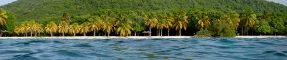
Bahia Chamela, and Perula town, Islas Cocinas, Isla Pajarera, and El Mamut
PHOTO ALBUM: https://photos.app.goo.gl/g98Lpa5NyTpz8QHWA Bahia Chamela, and Perula town Arriving after a comfortable passage of 6 hours we found yet another massive bay which was again lined by a beach many miles long. We anchored at the north western end … Continue reading
Posted in Weather
Leave a comment
Tenaticita area, Barra Navidad, Melaque, and onto Bahia Chamela
PHOTO ALBUM —>> https://photos.app.goo.gl/4bbDzaR9cHvPD4YGA Tenaticita area/Playa El Venadito Beach walks, birds, fish schooling The Tenaticita anchorage is wonderful for a number of reasons. The beach is perfect for walking and quite often at low tide there are shells to … Continue reading
Posted in Weather
Leave a comment
Barra Navidad & Lagoon, Secret Beach, Melaque, Tenicacica, Tequilla factory plus, crocodiles and market of La Manzanillo
PHOTO LINK —>> https://photos.app.goo.gl/ayVFMwtx3LK7D6Rr7 Arrival at Barra Navidad Again we spotted whales, many whales, slapping the water with their tails, and appearing to frolic in the seas. The scenery too was beautifully rugged and wild. Towards the end of … Continue reading
Posted in Weather
2 Comments
Zihuatanejo, to Manzanillo: Las Hadas and Bahia Santiago
PHOTO LINK: https://photos.app.goo.gl/2r3Q9k9xHTZS6yHD8 Zihuatanejo, or Zwhat for short, is a resort city on Mexico’s Pacific Gold Coast, northwest of Acapulco. It is famous for its beaches. For example the sweeping Playa La Ropa, which is the city”s shorefront and … Continue reading
Posted in Weather
Leave a comment
Crossing the Tehuantepec, Bahias Maguey, and Organo, Acapulco and Zihuatanejo
PHOTO ALBUM—->> https://photos.app.goo.gl/jZJcAp7RpkhXAQms5 Passage through Tehuantepec It was time to leave Chiapas. The Tehuantepec winds were going to lay down for a spell, enough time for us to travel through the area. What are the Tehuantepec winds? The … Continue reading
Posted in Weather
Leave a comment
Chiapas, Mexico
PHOTO LINK —>> https://photos.app.goo.gl/2GwL63q425M5AWud8 Chiapas, Mexico Puerto Chiapas is the southernmost port on Mexico’s Pacific coast, the closest port to the Guatemalan border, was our entry port into Mexico. It is relatively new port, built in 1975, and … Continue reading
Posted in Weather
Leave a comment
Cerro Verde, Herradura food festival, low tide, country wanders, meeting friends.
PHOTO ALBUM–>> https://photos.app.goo.gl/kHB3vSm1Y1BRXjzD9 Cerro Verde It was magnificent weather when we drove to Cerro Verde for the day. We set off early, still the massive roadworks near Sonate held us up. They look to be rebuilding … Continue reading
Posted in Weather
Leave a comment
Herradura, Puerta de Diablo, Ruta de Flors and the Botanical Gardens
PHOTO LINK—->> https://photos.app.goo.gl/qz2JxYnK98kEwL5CA Herradura Is the closest town to where we are located at Bahia de Sol Marina. To get there by car is 40 kilometers, by dinghy it is just over 3 miles. We had intended to … Continue reading
Posted in Weather
Leave a comment
Back in El Salvador, Costa Del Sol, Surf City/Libertad, Puerta del Diablo and Boqueron Sept/Oct
PHOTOS HERE —>>. https://photos.app.goo.gl/R13sUCgwSGqUhfMq7 Back in El Salvador Our plane arrived in El Salvador at 10:30am. Don and Andy met us at the airport in a rental car. They suggested we drive back via Libertad where we could have … Continue reading
Posted in Weather
Leave a comment
Bermuda August till September
PHOTO’S LINK—–>> https://photos.app.goo.gl/3H7C52ojUdq7dXXa7 Travel delays Off we set for Bermuda with many plans of what to do: maintenance on our house and Airbnb, house sitting for our son, being daycare for two grandchildren and other expectations of walks, … Continue reading
Posted in Weather
Leave a comment